
Rain, wind to impact Santa Barbara County Feb. 12-14
UPDATE: 2 P.M. Thursday, February 13
Rain is picking up over Montecito Thursday afternoon. Montecito Fire Department personnel and Santa Barbara County Flood Control assessment teams are monitoring the watershed. As of 2 p.m. Thursday, the watershed is managing rain runoff appropriately. No issues have occurred at any of our local creeks or debris basins.
At 1:40 p.m. Thursday, Montecito Fire responded to a call for lines down in the area of School House Road and Picacho Lane. Southern California Edison is en route to make repairs.
Additional resources are standing by in Montecito and throughout Santa Barbara, ready to respond to storm-related emergencies.
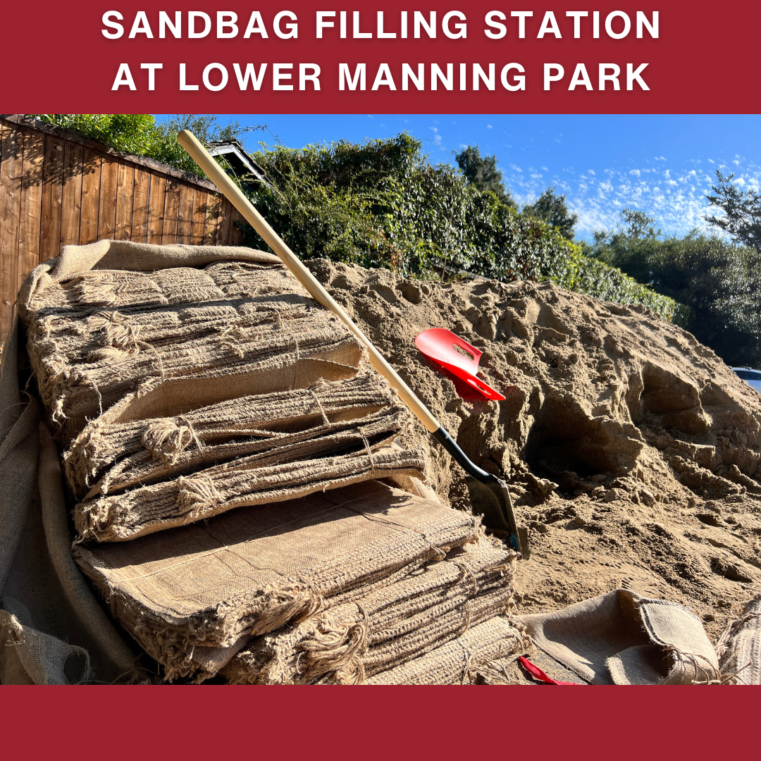
The sandbag filling station at Lower Manning Park remains stocked with sand. There are also numerous sandbag filling locations available throughout Santa Barbara County. We ask you to take what you need to protect your property and be mindful of others in the community who may also need sandbags.
___________________________________________________________________________


UPDATE: 3 P.M. Wednesday, February 12
The National Weather Service says the storm system will intensify slightly earlier than originally expected. The storm is expected to intensify over Santa Barbara County between 10 a.m. and 6 p.m. Thursday. All other forecast information remains unchanged. Please prepare for this storm event and be safe.
The sandbag filling station at Lower Manning Park is being consistently replenished with sand. However, if the pile is gone, please visit one of the other sandbag-filling locations throughout Santa Barbara County. We ask you to take what you need to protect your property and be mindful of others in the community who may also need sandbags.
___________________________________________________________________________
UPDATE: 3 P.M. Tuesday, February 11
According to the National Weather Service, the heaviest rain and peak storm activity will occur between 10 a.m. and 4 p.m. Thursday, February 13. All other forecast information remains unchanged. Please take steps to prepare for this storm event.
___________________________________________________________________________


Please take steps to prepare for rain and wind this week.
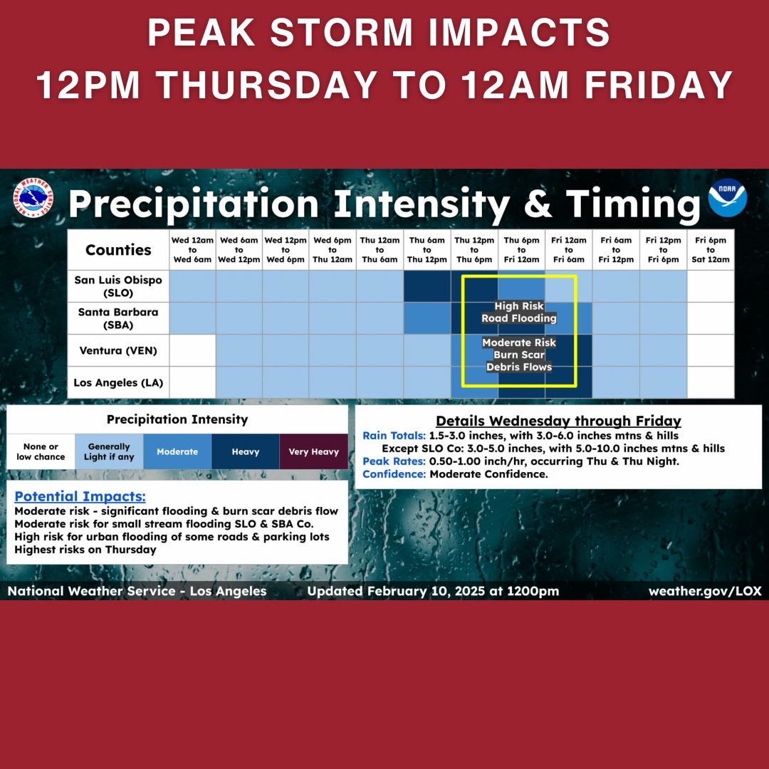
According to the National Weather Service, rain will begin Wednesday, February 12. Peak storm impacts are expected 12 p.m. Thursday through 12 a.m. Friday. Scattered showers will continue throughout the day Friday.
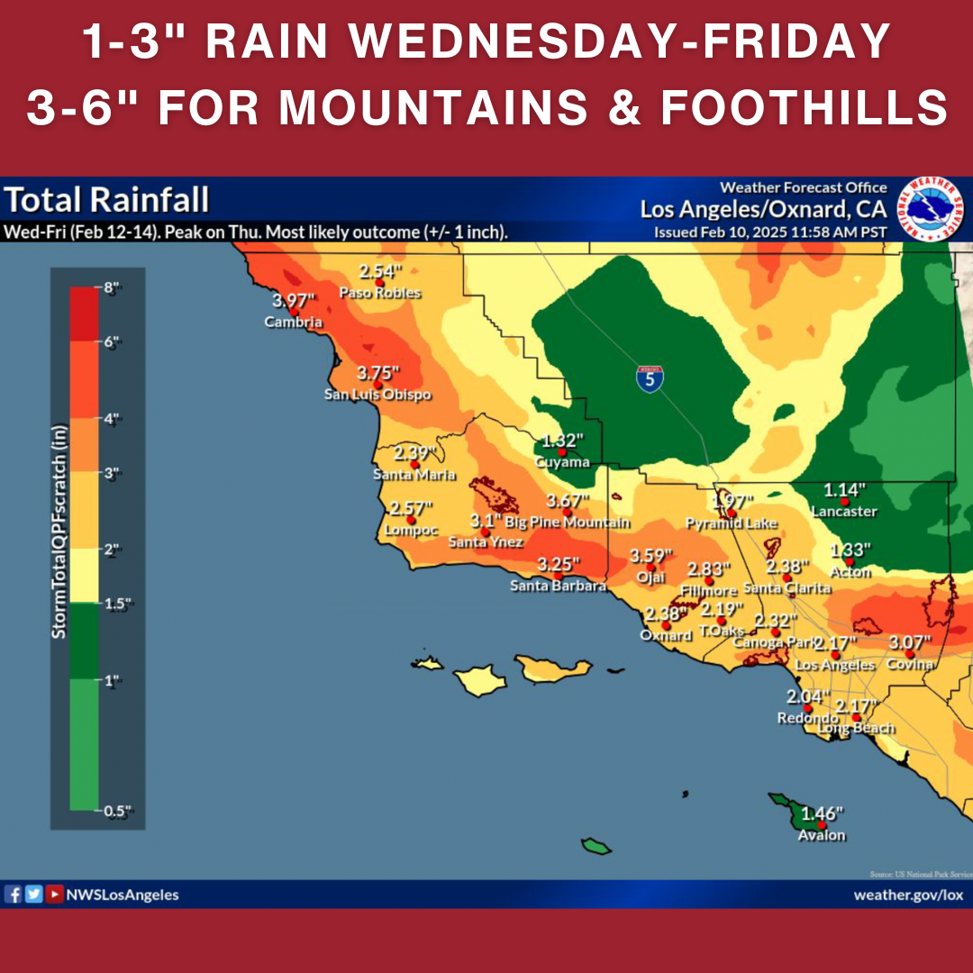
The expected rain totals from Wednesday to Friday are 1-3 inches at the coast and 3-6 inches for the mountains and foothills. Rain rates are anticipated to be generally 0.5-1 inch per hour.
Winds will begin to increase Tuesday ahead of the rain. During the storm, expect damaging wind gusts of 20-40 mph with isolated gusts to 60 mph possible.
Given the current forecast information, no evacuations are being considered for Montecito.
Please prepare now for potential storm impacts. Gusty winds may cause downed trees and power lines leading to isolated power outages. Be cautious of loose or falling rocks, mud, debris, and flooded roadways.
If you live in a flood-prone area and feel unsafe, or if the storm rapidly intensifies, we encourage you to make plans to evacuate. Please review the Storm Impact Consideration Map to see areas vulnerable to flooding.
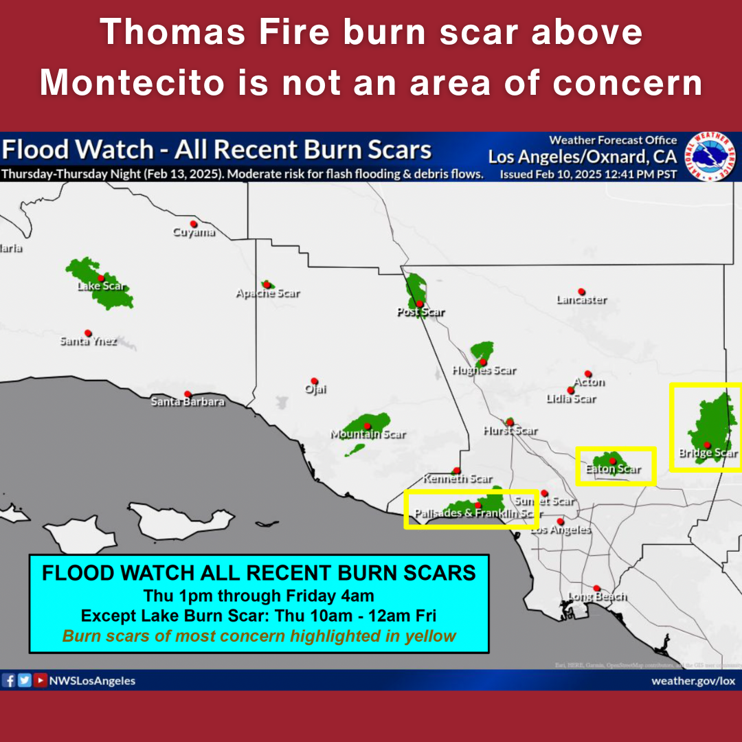
The Thomas Fire burn scar above Montecito is not an area of concern. Our debris basins have been cleaned out and improved ahead of the winter storm season. Santa Barbara County Flood Control will have assessment teams monitoring the watershed throughout the week.
Montecito Fire Department will have additional resources on duty, ready to respond to storm-related emergencies.
Listen to Montecito Fire Department’s AM1610 radio station for updates.
Register for ReadySBC Alerts at ReadySBC.org
A sandbag filling station is available for community members at Lower Manning Park. For those needing assistance with sandbags, please contact the Santa Barbara Bucket Brigade at 805-568-9700.